
Daniel Biagé summarizes the four key components PSAPs need in NG9-1-1 call handling and management systems to quickly pinpoint wireless caller location.
If you’re a regular reader of this blog, you may have noticed that we’ve written a few pieces about the capabilities available in NG9-1-1 systems to help PSAPs locate wireless callers faster. We’ve emphasized the topic so strongly because it’s fundamental to PSAPs’ operations. If you can’t locate callers, you can’t help them. And, if it takes too long to locate callers, it may be too late to help them.
Now, it’s time to put all the pieces together. Here are the four key components needed in an NG9-1-1 call handling and management system to locate wireless callers faster.A GIS Database
A geographic information system (GIS) database underpins the location capabilities in NG9-1-1 systems, providing numerous location details that are not available in Master Street Address Guide (MSAG), Emergency Service Number (ESN), and Automatic Location Information (ALI) databases. With a GIS database, PSAPs have access to details about key geographic elements, including:
- Road centerlines
- PSAP boundaries
- Emergency service boundaries
- Lakes, rivers, parks, etc.
PSAPs can also include data for street name aliases, landmark names, geopolitical boundaries, and other elements to enhance their GIS database.
Mobile Device Location Data
Most modern mobile devices include built-in location capabilities. In mid-2018, leading mobile phone manufacturers and industry organizations began announcing plans to share that data.
- Apple will share Hybridized Emergency Location (HELO) data that combines cell tower location information with GPS and Wi-Fi access point information on the device.
- Google will use its Android Emergency Location Service (ELS) service to transmit faster and more-accurate emergency location information for wireless calls.
- Wireless industry association, CTIA, announced that national wireless providers AT&T, Sprint, T-Mobile, and Verizon will integrate device-based hybrid (DBH) location technology solutions to help resolve the issue.
Location data from Apple iOS 12 and Google Android wireless devices is available to Solacom customers through the RapidSOS NG911 Clearinghouse, a Solacom partner.
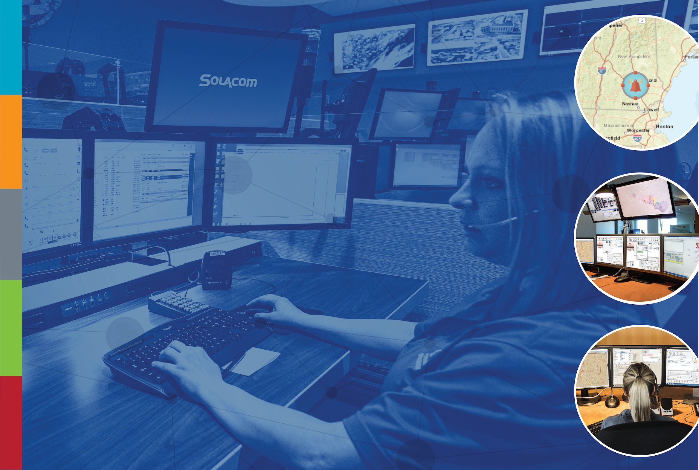
Advanced Call Handling and Management
A full-featured NG9-1-1 call handling and management solution, such as Solacom’s Guardian 9-1-1 Call Handling solution, allows call takers to make the most of location data — whether they’re communicating with callers or interacting with response teams on the move. Now, they can use advanced call distribution, call transfer, and conferencing features to quickly and easily get location data to the people who need it most.
For insight into how advanced call handling and management features improve PSAP operations, read the article Next Generation Conferencing Saves Lives.
An Integrated, Interactive Map
An integrated mapping application allows call takers to see the location and status of all calls at a glance. They can even answer and manage calls through the map, automatically zooming to the active call location when the call is answered.
The map can also be used to isolate and view only certain types of locations, such as schools or banks, and to visually track caller movements.
Get More Information
To learn more about how to optimize GIS data to pinpoint caller location, check out our white paper "Locating Callers Faster: Optimizing GIS Data and Mapping to Pinpoint Caller Location."
For more information about the technologies and data required to locate wireless callers faster, download our white papers:
Improving Wireless Call Handling in 9-1-1 Centers: The Data and Technologies Needed to Make It Happen Today